Innovate
USF app crowdsources flood data to predict future risk
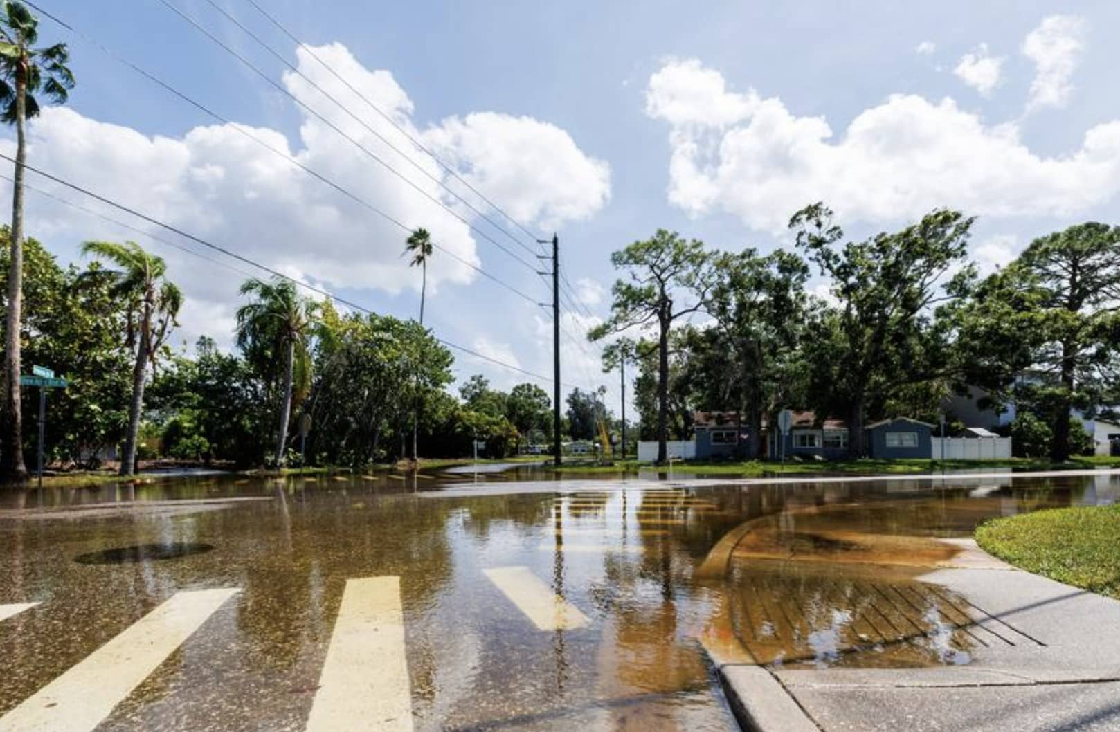
As the Gulf Coast continues to deal with the damage Hurricane Helene left behind, a team of researchers at the University of South Florida (USF) St. Petersburg campus is using crowd-sourced flood data to help predict future risk with a web-based application.
The CRIS-HAZARD app allows Pinellas County residents to view and upload real-time flood information, including photos and videos. This crowdsourced data is combined with other geographic information to create a comprehensive picture of flooding events in coastal communities.
The app, which is free to use, was piloted in 2023 by a team of USF researchers with the help of a $1.5 million grant from the National Science Foundation. The app launched to the public just a few days before Hurricane Helene rocked the Gulf Coast.
Led by USF St. Petersburg Geographic Information System and Remote Sensing Professor Dr. Barnali Dixon, the research team aimed to harness the power of community engagement and artificial intelligence technology to identify which areas are at a higher risk of flooding, and how the risk evolves over time.
“I realized that if we can collect the data from the people and their lived experiences by way of them uploading pictures, then we can use AI to extract the flooding information to determine low, moderate, high or absence of flooding,” said Dixon, who is also executive director of USF’s Initiative on Coastal Adaptation and Resilience (iCAR). “One of the ways we can predict [flooding] and protect people is by actually developing an accurate model, so we need lots and lots of data to calibrate and validate the model.”
Dixon has been working with community leaders in St. Petersburg’s Childs Park neighborhood for several years, where residents have successfully used the system to prepare for extreme storm events. Through the app’s website, residents can view maps and see their risk of storm surge and sea level rise. They can also share their own information and suggest ways to improve the system. When residents upload new photos or videos to the website, they’re processed through the AI model and posted nearly instantly.
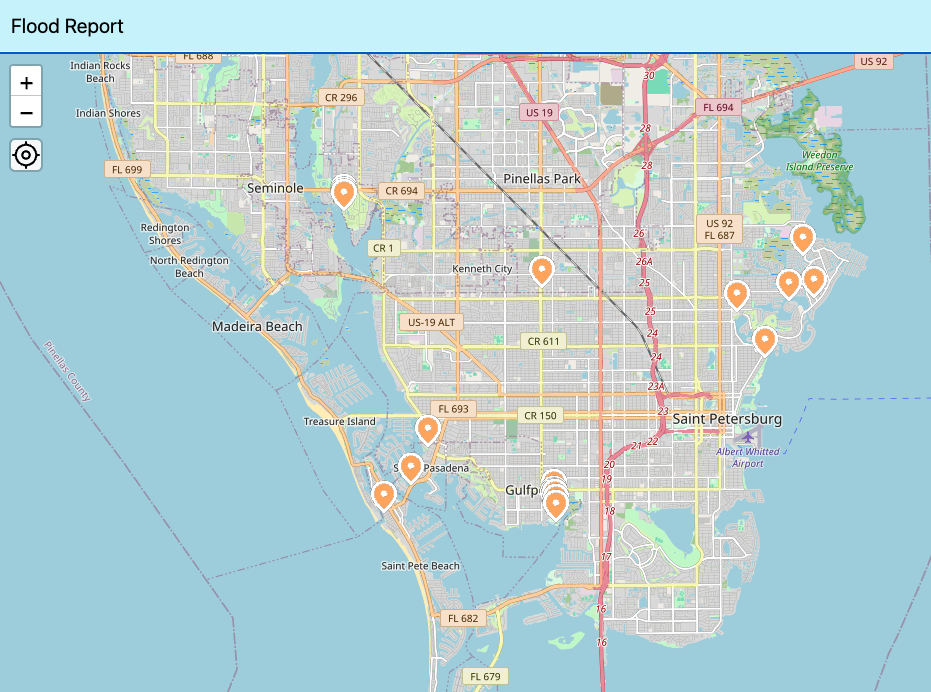
Anyone who visits the CRIS-HAZARD app can see a map with information and community-submitted photos and videos of flooding in the area. Screengrab: flood-report.cris-hazard.org.
The app is based on the existing Community Resiliency Information System (CRIS), a website created in 2020 by iCAR. After Hurricane Ian in 2022, Dixon and her team used the gathered data to map areas identified as coastally vulnerable communities that experienced inequitable access to disaster relief and assistance. This information can be used by policymakers and neighborhood leaders to make decisions about policy and resource allocation for future storms.
The data also allows emergency managers who are involved in evacuation orders to identify areas with concentrations of people who need transportation assistance or are reliant on power for medical needs.
“I want people to test the app. It doesn’t have to be a named storm; it can be an afternoon storm,” Dixon said. “If your area, neighborhood or backyard is flooding from an afternoon storm, what will happen in an extreme weather event? We want to have that data uploaded so we can systematically see how much water is accumulating and where.”
In addition to real-time reporting, the app includes future flood projections, allowing users to view potential flooding scenarios 10 to 30 years in the future. The team is also working on downscaling these projections for more accurate, localized predictions.
Dixon added that they’re installing 35 static cameras throughout Pinellas County to gather even more data, including the precise location and elevation of the water in flooded areas, to improve future predictions. Dixon envisions the app playing a crucial role in disaster management.
“No one knows what is going on in their neighborhood better than the people themselves. Somebody coming from FEMA, scientists, modelers and academics, they do not have the lived experience,” she said. “That is the power of this app. If I can take people’s lived experience and make it into data, and that data can be incorporated into the models to improve [flooding] predictions, we are changing the game. That’s where we are heading for.”
The CRIS-HAZARD app can be accessed online at flood-report.cris-hazard.org.
.


