Know
Idalia makes landfall in Big Bend; flooding, outages in Tampa Bay
This story will be updated as the situation warrants.
11:20 p.m.: A St. Pete Beach lift station along 59th Avenue has lost power and cannot move water. City officials urge area residents to refrain from using the sanitary system for any purpose. The system could “back up over the next few hours, which could impact homes in the area.”
10:50 a.m.: Bayfront Health medical offices and outpatient clinics remain closed today. Free-standing emergency rooms and Bayfront Health St. Petersburg Hospital are open and operational.
10:30 a.m.: Mayor Ken Welch said about 4,000 homes and businesses remain without power in St. Petersburg, and 22,000 Duke Energy customers lack electricity throughout Pinellas County. Jeff Baker, government and community relations manager for Duke, said crews restored service to about 37,654 customers by 10 a.m.
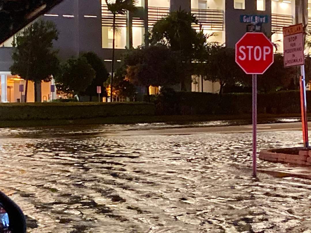
3 p.m.: The Howard Frankland Bridge, Sunshine Skyway and eastbound lanes on the Courtney Campbell Causeway remain closed. The Tampa International Airport and St. Pete-Clearwater International Airport are reopening. Bridge access to the barrier islands is expected to remain closed until at least this evening due to ongoing flooding caused by a combination of storm surge and high tides, according to the county. St. Pete Fire and Rescue has rescued over 75 St. Pete residents.
4 p.m. The Howard Frankland Bridge and Gandy Bridge reopen.
More than 75 people rescued by our @StPeteFR team in high-flood areas. Boats are still deployed and continue rescue efforts.
We’re in this together, St. Pete.
727-893-7111 pic.twitter.com/zpxorkHGfS
— St. Petersburg, FL (@StPeteFL) August 30, 2023
Hurricane Idalia made landfall just before 8 a.m. Wednesday near Keaton Beach, in Florida’s Big Bend area, according to the National Hurricane Center, as a Category 4 storm with maximum sustained winds of 125 mph.
Keaton Beach is in Taylor County, approximately 200 miles north of St. Petersburg.
Flooding and power outages have been reported in St. Petersburg and on the Gulf barrier islands.
The National Hurricane Center is issuing advisories on Hurricane Franklin, located a couple of hundred miles west-northwest of Bermuda, and on Tropical Depression Eleven, located several hundred miles east-southeast of Bermuda.

Flooding on the St. Pete Pier Wednesday morning. Photo by Rui Farias, executive director of the St. Petersburg Museum of History.