Thrive
Saildrone goes hurricane hunting
A company operating out of St. Petersburg’s Maritime Defense and Technology Hub is using its uncrewed surface vehicles (USVs) to gain a better understanding of how hurricanes rapidly grow and intensify.
While headquartered in Alameda, California, Saildrone conducts ocean mapping operations from the St. Petersburg Innovation District’s waterfront Hub. In partnership with the neighboring National Oceanic and Atmospheric Administration (NOAA), one of the company’s USVs set sail for the Gulf of Mexico Tuesday, where it will collect and transmit critical data in real-time throughout the 2022 hurricane season.
Today’s event was part of Saildrone’s second annual hurricane mission. Last year, one of its USVs provided the first-ever live video footage from inside the eye of a Category 4 hurricane. NOAA researchers use the data collected by the semi-autonomous vessels to improve forecasting models. The information is also available to 20 agencies worldwide.
Capt. Philip Hall, director of NOAA’s Uncrewed Systems Operations Center, explained the USVs gather valuable information from the ocean’s surface unreachable by “hurricane hunter” aircraft.
“That’s where these highly autonomous systems really play a very important role,” said Hall. “I think they’re really transforming how NOAA meets its mission.”
The saildrones transmit meteorological and oceanographic data to researchers in real-time. That includes air temperature, relative humidity, barometric pressure, wind speed and direction, water temperature and salinity levels and wave height.
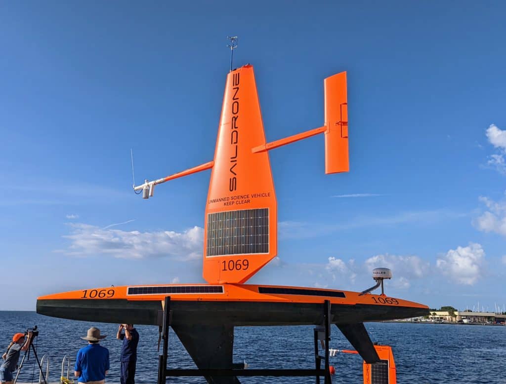
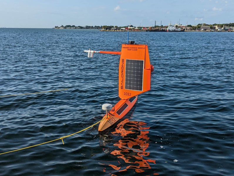
A larger Saildrone USV sits outside its ocean mapping headquarters at St. Pete’s Maritime and Defense Technology Hub.
In addition to the USV launched from the Port of St. Petersburg Tuesday, which will take one to three weeks to reach its mission destination, Saildrone deployed six other uncrewed vessels from Jacksonville and the U.S. Virgin Islands earlier this summer. The rest of the fleet will chase hurricanes throughout the Atlantic Ocean and the Caribbean Sea.
Hall noted the saildrones work in conjunction with several underwater gliders, and operators can direct them to the area of a storm that provides the most valuable information.
“And then they can be out for weeks or months at a time in the ocean,” added Hall. “It can collect data before the storm, during the storm and then after the storm. This is a very unique data system that these systems bring.”
John Cortinas, director of NOAA’s Atlantic Oceanographic and Meteorological Laboratory, called Saildrone’s hurricane mission an “outstanding” example of public, private and academic partnerships. He said collaborations like those are critical to achieving the research needed to benefit the nation and its citizens.
Cortinas explained that the ocean’s surface plays a critical role in hurricane formation and intensification. He said data provided by Saildrone’s USVs has led to more accurate intensity forecasts, potentially saving lives.
“Partnering with companies like Saildrone allows us to venture into some of the most powerful parts of the surface of a hurricane – without risking human life,” said Cortinas. “That’s critically important in order to advance our understanding of these extremely dangerous storms.”
According to an accompanying press release, a Saildrone USV withstood 100-foot waves and 140 mph winds as it navigated through the eyewall of Category 4 Hurricane Sam in the Atlantic last year.
Matt Womble, director of ocean data programs for Saildrone, showcased the company’s mission portal inside the hub. He called the cluster of screens a data dissemination tool for NOAA scientists and other clients.
The portal data also allows for communication between organizations to coordinate efforts, and Womble showed a screen tracking a USV trailing an NOAA glider. The USV, he said, is collecting critical data to provide forecasters with a better sense of current ocean conditions.
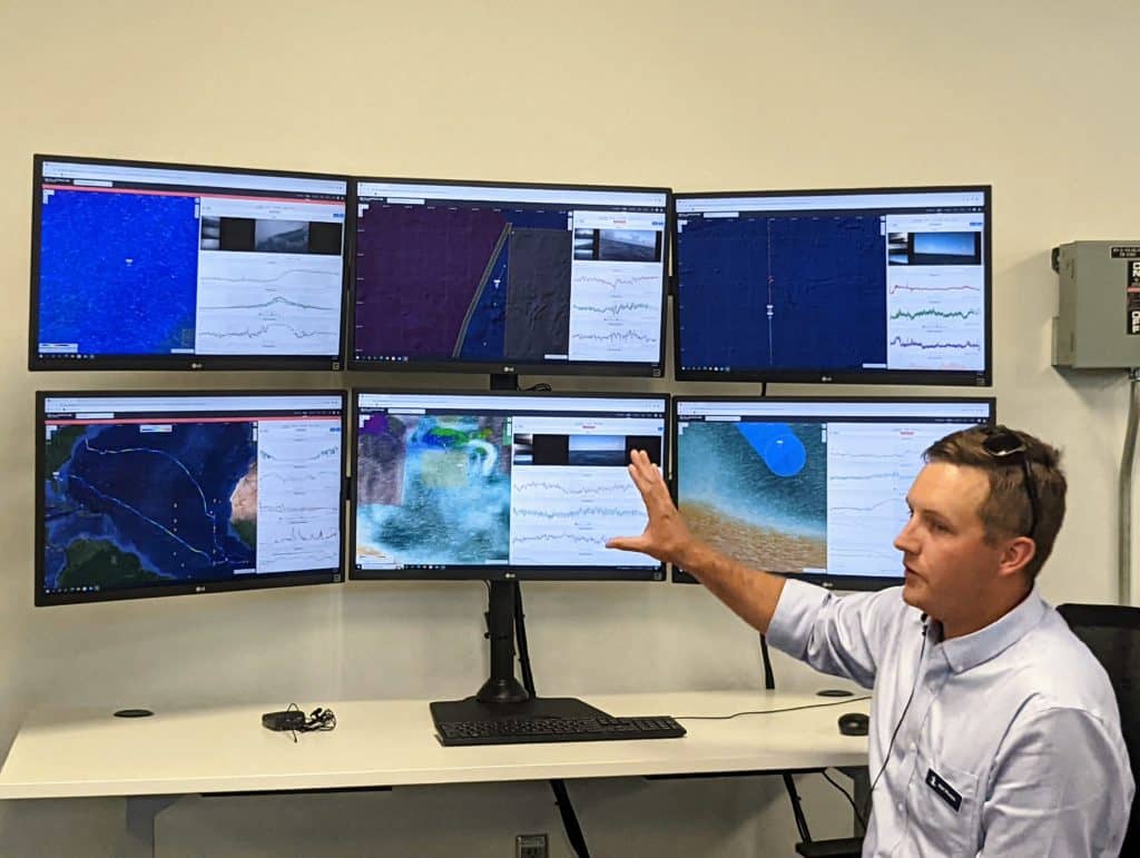
Matt Womble, director of ocean data programs for Saildrone, showcased the company’s mission portal.
“While we’re waiting for storms to develop in the Gulf, we’re constantly doing work,” explained Womble. “It’s not just idly sitting out there waiting. “
Having a base of operations in St. Pete, said Womble, provides a forward operating location to deploy assets and station pilots. While the USVs are semi-autonomous, he said humans are constantly “in the loop,” monitoring the feeds and the status of the vehicles.
Womble added that Saildrone expects to continue growing the size and scope of its ocean mapping and hurricane missions, and having a waterfront base with direct access to the Gulf and close proximity to the Atlantic is invaluable.
According to the release, NOAA predicts an above-average hurricane season, with up to 21 named storms and three to six “major” hurricanes.